Pioneers in Drone solutions
- 100% Free Consultation
- No contract required
Specifically tailored to your needs to provide maximum efficiency
Many people believe that UVA or drones are primarily used for military, topographic, or entertainment purposes, however the purpose of drones extends well beyond these applications and opens up new opportunities.
Agricultural and livestock farmers can use drones to get an aerial view of a certain site or area where their cattle or plantations are managed. Thermal imaging technology provides for remote monitoring of livestock, stray or unhealthy animals, as well as speedy and effective issue resolution.
Drones combined with a multispectral sensor can be used by agricultural farmers to collect accurate data on the health of their plantations, water distribution, and pesticide regimens, all of which are essential in today’s precision farming. Drones in agriculture will assist address water shortages and chemical overspray by increasing production and lowering costs.
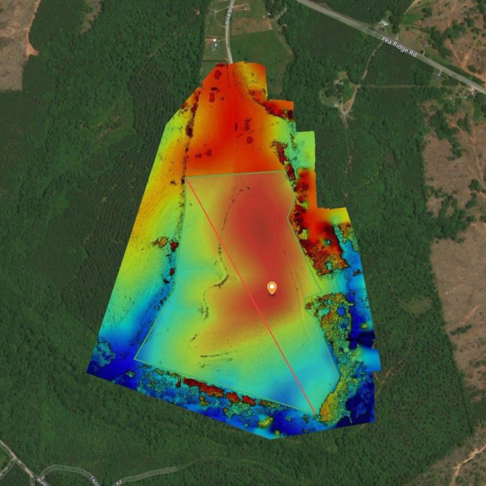
Once the farm has been plotted on a map on the computer and the GPS co-ordinates of areas that require monitoring are recorded, the data is used to programme the drone’s regular flight path. It flies at maximum speed until it approaches the co-ordinates, then it slows down to take live video footage of the ‘hotspot’ from a pre-programmed altitude.
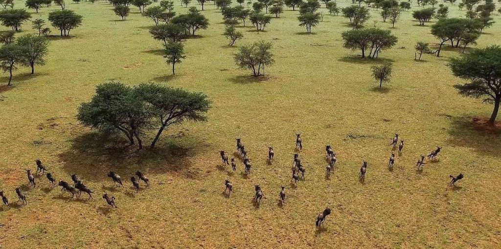
The drone can also be used to search for missing stock. Where it is unable to obtain an adequate visual sighting through dense bush, the drone switches to its thermal imaging camera. Other applications for farmers include counting game or livestock, aerial mapping of farms, and checking pivots and water levels in dams. A drone can be used for day or night patrols. It can fly for 45 minutes and has a top speed of 120km/h.
The Game Farmer also kept an eye on things by
utilizing drones to cultivate procedures for controlled monitoring in order to
expand their wildlife research operations. Drones are becoming
increasingly popular for conservation purposes since they allow gamekeepers to
keep an eye out for poachers, maintain track of the species, monitor the
population number, and safeguard the terrain. In fact, wildlife surveys
conducted by UAVs are typically far more effective than those conducted by
conservationists on the ground.
The process by which the location and health of
wildlife and game are monitored is known as wildlife control. The methods used
vary based on the size of the area and the quantity of wild animals there, but
all should be capable of providing information on the game’s location and condition.
Yes! Not only we deliver contrywide, but we also provide on-site training for your staff in a form of compulsory workshop.
Standard warranty for all our products is one year. We also offer service agreements, which our consultants will gladly advice you on.
Unfortunately not at the moment, but we are in communication with relevant authorities and hope to offer this service soon.
This is highly dependent on the application you are planning to use our drones for. Rest assured, our consultants will advice you on the best possible solution for your needs.
Certainly. This will, however, require specialized camera, night-vision or thermal, for example. Please call our consultants for details, specific to your application.